The East
The map of the U.S. looks like it was speeding eastward, ran into a wall at the Atlantic, and the seaboard states acted as a crumple zone. This is probably not what happened; it is more likely that the level of technology of governance, the assorted aspirations and identities of different groups of colonists, and assorted accidents of history conspired to make most of the first states rather teensy.
Nevertheless, the seaboard states seem compacted, intensified, and perhaps slightly concussed. Out West, it can take a good day to drive at 60 across some states; you can walk across Rhode Island in that time. But it isn’t as though Montana, for instance, had been cut into very small pieces, each one a state, but that you had instead compressed everything there into an impossibly small area, and then raised the population an order or two of magnitude. It’s like building a singularity out of humans, and as with a singularity there’s an immensely powerful gravitational well that keeps everyone and everything in, and is always trying to draw even more in. Every Eastern state, no matter how godforsaken corrupt, corroded, and crowded it might look to our eyes, is inhabited by people with a fierce sense of identity and pride of place. Okay, and despair and bitterness too, but work with me here. People strive here, in a way that most people from the other Coast cannot readily comprehend, let alone emulate.
This impression is amplified after the long jaunt by train across the broad, open plains. Out there the landscape goes by like this: farm……..farm……..town…….. forest……..city……..suburb……..farm……..indu
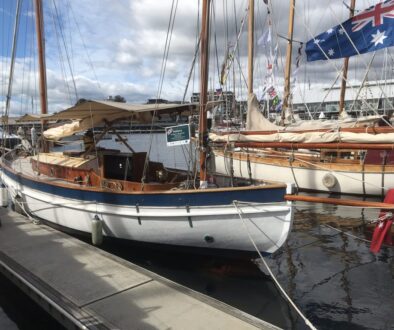
Ahem. We rented a car, drove out of that place to the relatively serene and egalitarian utopia of the Annapolis boat show.


